Googling the Whistler weather forecast for winter 2026/2027? You have probably seen the same two words everywhere: El Niño.
This winter, El Niño is no longer just a possibility. As of August 2026, NOAA has an El Niño Advisory in effect and says there is a greater than 90% chance of a very strong El Niño during fall and winter 2026/2027. El Niño conditions are already present and strengthening.
That sounds dramatic, so does it mean a bad Whistler ski season? Not necessarily.Whistler's historical El Niño snowfall numbers are considerably more encouraging than most skiers would expect.
There are genuine reasons to expect a warmer winter overall, and an increased risk of high freezing levels and rain at lower elevations. But there are equally legitimate reasons why Whistler Blackcomb may be unusually well positioned to handle an El Niño winter, and why winter 2026/2027 could still deliver major snowstorms, deep alpine snow and some spectacular skiing.
The most interesting part? Some of Whistler's historical El Niño statistics are surprisingly good, and this guide breaks them down month by month so you can skim, plan, and actually enjoy reading the forecast.
2026/2027 Whistler Winter Forecast at a Glance
- ENSO: El Niño is strengthening, with NOAA giving a greater than 90% chance of a very strong event.
- Temperature: Warmer than normal conditions are favoured overall.
- Whistler mid-mountain: Historical strong El Niño signal is close to neutral.
- Best historical month: January.
- Average Whistler snowfall: 422 inches / 1,072 cm annually.
- Main risk: Higher freezing levels and rain at lower elevations.
- Main upside: Moist Pacific storms arriving during colder windows.
This forecast will be updated as new seasonal guidance becomes available closer to winter.
Planning around January or February? Browse live availability for AceHost Whistler winter homes.
Book Whistler Winter StaysStart here
The Quick Whistler Winter 2026/2027 Forecast
Our early prediction
Winter 2026/2027 will most likely be warmer than normal in Whistler, particularly at lower elevations, but that does not automatically translate into dramatically below-normal alpine snowfall.
The latest OpenSnow outlook does favour below-normal snowfall for British Columbia overall during a strong El Niño.
However, there is a very important Whistler-specific exception buried inside that broader forecast:
Whistler's mid-mountain historical signal is close to neutral during strong El Niño winters.
The bigger vulnerability is at the base, where warmer temperatures increase the chance that precipitation falls as rain instead of snow.
OpenSnow also sees January as the most promising month for British Columbia, with an above-average historical snowfall signal.
That distinction matters enormously.
Whistler Blackcomb's official mountain statistics list:
Whistler by the numbers
- 1,072 cm, or 422 inches, of average annual snowfall
- 8,171 acres of skiable terrain
- A highest lift-accessed elevation of 2,284 metres, or 7,497 feet
- A base elevation of approximately 675 metres, or 2,214 feet
- More than 200 marked trails
- 36 lifts
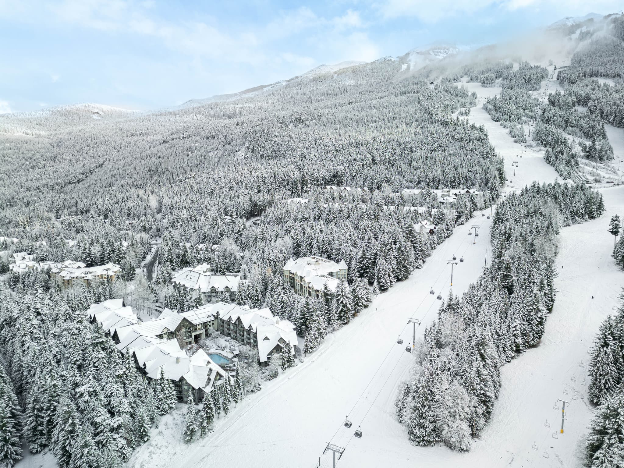
There is more than 1,600 vertical metres of elevation difference between the base and highest lift-accessed terrain.
In a winter when freezing levels fluctuate, that vertical range becomes a major advantage.
It can literally be raining in Whistler Village while snow is accumulating rapidly thousands of feet above.
And for skiers, what is happening at 1,500 to 2,200 metres often matters much more than what is falling outside the coffee shop in the Village.

The basics
First, La Niña vs. El Niño: What Is Actually Happening?
During La Niña, cooler-than-normal water develops across the tropical Pacific. For Western Canada, La Niña is generally associated with a greater probability of cooler, stormier winter conditions.
Skiers love hearing the words La Niña for exactly that reason.
El Niño is the opposite phase.
Warmer tropical Pacific water alters large-scale atmospheric circulation and can shift the Pacific jet stream and storm tracks.
For the 2026/2027 winter, NOAA says El Niño is already strengthening and has a greater than 90% chance of reaching the “very strong” category during the Northern Hemisphere fall and winter.
So we are not going to pretend that a textbook strong El Niño is theoretically better for Whistler than a strong La Niña.
It isn't.
If someone offered us the choice between an idealized strong La Niña and an idealized strong El Niño purely from the perspective of Whistler snowfall, we would take La Niña.
But there is a huge difference between saying:
“El Niño increases the probability of a warmer Whistler winter.”
and saying:
“El Niño means Whistler will have a bad ski season.”
The first statement is reasonable.
The second is not supported by Whistler's actual historical snowfall record.
The data
Here Is the Statistic That Should Get Whistler Skiers Excited
OpenSnow analyzed snowfall at Whistler during seven significant El Niño seasons and compared snowfall through March 31 against a 30-year normal of 914 cm.
Here were the results:
| El Niño Winter | Snowfall Through March 31 |
|---|---|
| 1982/1983 | 946 cm |
| 1986/1987 | 882 cm |
| 1991/1992 | 907 cm |
| 1997/1998 | 876 cm |
| 2002/2003 | 921 cm |
| 2009/2010 | 1,165 cm |
| 2015/2016 | 1,018 cm |
| 30-year normal | 914 cm |
Whistler Snowfall During Significant El Niño Winters
Snowfall measured through March 31 vs. 30-year normal
Average across these seven El Niño winters: 959 cm, approximately 5% above the 914 cm normal.
Four of those seven significant El Niño seasons produced above-normal snowfall through March 31.
But it gets more interesting.
Add those seven El Niño seasons together and Whistler averaged approximately:
959 cm of snow through March 31.
The 30-year normal was 914 cm.
In other words, across that particular seven-winter dataset:
Significant El Niño winters averaged approximately 5% MORE snow than Whistler's 30-year normal through March 31.
Even the median was approximately 921 cm, essentially right around normal.
And the lowest of those seven winters came in at 876 cm, only around 4% below the 914 cm normal.
That is an extraordinarily important piece of context.
It absolutely does not mean winter 2026/2027 is guaranteed to be above average. Seven winters are a relatively small sample, and every El Niño develops differently.
The current El Niño may also become exceptionally powerful, so this year's atmospheric pattern will not necessarily reproduce those previous winters.
But the data clearly demonstrate something important:
“Strong El Niño = no snow in Whistler” is simply not supported by Whistler's historical record.
Whistler Has Already Had Excellent Snow During Very Strong El Niño Winters
Take the famous 1982/1983 El Niño.
That was one of the strongest El Niño episodes on record.
Whistler still received around 495 inches of snowduring the winter according to OpenSnow's historical Western ski-season analysis.
That is more than 12.5 metres.
Then consider 2015/2016, another exceptionally strong El Niño winter.
Whistler recorded approximately 1,018 cm through March 31, compared with the historical 914 cm normal used in the OpenSnow analysis.
Again, this does not mean every powerful El Niño will produce a huge Whistler winter.
The extremely strong 1997/1998 El Niño, for example, came in somewhat below normal in the same dataset.
The point is that El Niño changes probabilities. It does not determine an entire ski season.
Whistler has already demonstrated that it can have an extremely snowy winter while one of the strongest El Niño events on Earth is occurring in the Pacific.
Best months
Even More Interesting: El Niño May Shift Whistler's Best Snow Deeper Into Winter
This might be our favourite statistic of the entire forecast.
When OpenSnow examined seven significant El Niño winters at Whistler, the monthly snowfall pattern looked like this relative to historical norms:
- November: 94% of normal
- December: 84% of normal
- January: 138% of normal
- February: 127% of normal
- March: 96% of normal
- April: 81% of normal
When Does Whistler Get the Most Snow During El Niño?
January snowfall was above average in five of the seven significant El Niño seasons studied.
That means the historical pattern is not simply “less snow.”
Instead, those El Niño winters tended to concentrate more snowfall into the heart of the ski season.
During a typical Whistler season, December is usually one of the giant snowfall months.
During these significant El Niño seasons, January became the snowiest month on average.
And February performed extremely well too.
For anyone considering a January or February 2027 Whistler ski trip, that is a genuinely interesting statistic.
It also lines up surprisingly well with OpenSnow's newest 2026/2027 outlook, which identifies January as having an above-average historical snowfall signal for British Columbia.
How Can a Warmer Winter Sometimes Produce Huge Snowstorms?
This sounds contradictory until you understand how mountain snowfall works.
Warmer air is capable of carrying more moisture.
NOAA notes that, on average, the atmosphere can hold approximately 7% more water vapour for every 1°C of warming (NOAA Climate.gov).
That does not mean warmer weather automatically creates more snow.
Temperature still matters enormously.
But imagine a moisture-rich Pacific storm approaching Whistler.
If the freezing level is 2,400 metres, much of the mountain could receive rain.
Bad.
But if essentially the same moisture-rich system arrives while colder air has pushed the freezing level down to 1,000 or 1,200 metres, suddenly an enormous quantity of that moisture can fall as snow across much of Whistler Blackcomb.
Very good.
That is one of the key things to understand about this winter.
The biggest question may not be how much moisture reaches Whistler.
It may be how cold the mountain is when the wettest storms arrive.
A relatively warm seasonal average does not prevent individual weeks, storms or cold fronts from being much colder.
If one of those cold windows overlaps with a powerful Pacific moisture plume, Whistler can accumulate snow extraordinarily quickly.
Whistler Has a Giant Moisture Source Sitting Beside It: The Pacific Ocean
Whistler's snow machine begins over the Pacific.
Pacific storms carry huge amounts of moisture toward the Coast Mountains.
Then the mountains themselves help squeeze that moisture from the atmosphere.
When moist air reaches mountainous terrain, it is forced upward. The rising air cools, and that process can enhance precipitation on the windward side of the mountains. This is known as orographic lift. NASA specifically notes that wind flowing up mountains tends to enhance precipitation as the air rises and cools.
Whistler is exceptionally well positioned to take advantage of that process.
So the recipe for an enormous Whistler snowstorm is surprisingly simple:
Pacific moisture + favourable storm track + cold enough temperatures + Coast Mountain uplift = a lot of snow.
El Niño can alter the storm track.
It does not switch off the Pacific Ocean.
And that distinction is extremely important.

Why “Warmer Than Average” Can Be Misleading for Skiers
Suppose winter finishes 1°C warmer than normal.
That does not mean every day was exactly 1°C warmer.
The season could instead contain:
- Several unusually mild periods
- Plenty of completely normal winter days
- A couple of cold outbreaks
- Three major Pacific storm cycles
- A few warm atmospheric-river events
- Several perfectly timed cold fronts
All of that can average out to a “warm winter.”
But the skiing could still include dozens of excellent powder days.
Seasonal forecasts describe averages over periods of months.
They do not tell us whether Whistler will receive 60 cm of snow over a particular January weekend.
Environment Canada makes the same distinction when discussing seasonal precipitation forecasts. Its precipitation outlook represents total liquid water and includes rain, snow, freezing rain and other forms of precipitation. It explicitly warns that an above-normal precipitation forecast does not automatically mean more snow.
The reverse logic matters too.
A seasonal temperature forecast cannot tell you what the freezing level will be when Whistler's biggest individual storms arrive.
For skiers, those individual storm cycles are what can make or break a week.
Whistler Is Almost Two Different Climates in One Resort
One of Whistler's biggest advantages in a warmer winter is elevation.
There is a massive difference between weather at Whistler Village and weather in the alpine.
Whistler Blackcomb's official stats put the resort's base at approximately 675 metres and the highest lift-accessed elevation at 2,284 metres.
That is more than 1,600 vertical metres of difference.
On marginal-temperature storm days, guests can wake up to rain or wet snow near the Village and ride into full winter conditions higher on the mountain.
This is why judging Whistler snow conditions from a Village weather app can be incredibly misleading.
A forecast showing +3°C in Whistler Villageabsolutely does not mean +3°C across Whistler Blackcomb's alpine terrain.
For winter 2026/2027, this elevation distinction could be particularly important.
Why Whistler May Be One of the Better B.C. Bets During El Niño
A broad British Columbia weather forecast can hide enormous local differences.
OpenSnow's preliminary 2026/2027 winter outlook currently favours below-normal snowfall for British Columbia overall.
But its Whistler-specific analysis is considerably more encouraging.
OpenSnow says:
- Whistler's mid-mountain historical signal is close to neutral
- Whistler's base is more vulnerable to rain events because of warmer temperatures
- January has an above-average snowfall signal
- Several other famous B.C. regions have clearer below-average signals during strong El Niño winters
That is a very interesting distinction.
Whistler may not escape the warm El Niño pattern entirely, particularly near the Village and lower mountain.
But compared with much of the province, its enormous snowfall baseline and mid-mountain historical performance give it a surprisingly strong case.
And that is before considering Whistler's vertical range.
A lower-elevation ski area has less room for error when freezing levels rise.
Whistler has thousands of vertical feet of it.
How Does Whistler Compare With U.S. and European Ski Resorts This Winter?
Whistler's real competition is obviously not limited to British Columbia.
Travellers deciding where to ski in winter 2026/2027 are also comparing Whistler with Mammoth, Lake Tahoe, Park City, Alta, Snowbird, Vail, Aspen, Breckenridge, Jackson Hole, Big Sky and the major ski resorts of France, Switzerland, Austria and Italy.
And this is where we need to be honest.
Some U.S. ski regions currently have a more favourable El Niño snowfall forecast than Whistler.
OpenSnow's August 2026 outlook favours above-normal snowfall in California, Utah, and Southern and Eastern Colorado.
Mammoth and the Central Sierra currently have one of the stronger snowfall signals. Utah also looks encouraging, particularly from January through March. Meanwhile, major Central Colorado destinations including Vail, Breckenridge and Aspen currently sit closer to an equal-chances or neutral snowfall signal.
So if we were ranking resorts exclusively by today's long-range forecast map, Whistler would not automatically be number one.
But there is another way to look at it.
Whistler's normal snowfall is 422 inches.
If Whistler received only 90% of normal snowfall, that would still equal approximately 380 inches.
At 85% of normal, Whistler would still receive approximately 359 inches.
At 80% of normal, it would still receive approximately 338 inches.
Those are not predictions. They are simply a useful way to understand how high Whistler's normal snowfall baseline actually is.
This is one reason a headline saying “Whistler below average” can sound worse than the skiing actually is.
Whistler does not need a record year to have a huge amount of snow.
What about Europe?
Europe is even harder to compare directly.
El Niño has a much less consistent relationship with winter weather in Europe than it does across North America.
The current OpenSnow outlook does favour above-normal snowfall across parts of the core Alps, including France through Western Austria, while also forecasting above-normal temperatures that could cause higher snow levels at lower elevations. ECMWF similarly explains that El Niño's influence on Europe occurs through complex atmospheric teleconnections rather than a simple direct relationship.
Very high European resorts such as those in the French and Swiss Alps have an obvious altitude advantage in a warmer winter.
Whistler's counterweight is moisture and snowfall volume.
The Coast Mountains sit beside the Pacific, and Whistler begins with a normal annual snowfall of more than 10 metres.
So there is no scientifically responsible way to declare in August that Whistler, Mammoth, Utah or the Alps will “win” winter 2026/2027.
But there is a very reasonable case that Whistler offers one of the world's strongest all-around margins for error:
Huge average snowfall. Huge vertical. Huge terrain. Pacific storm potential. And a surprisingly resilient historical El Niño record.
That combination is difficult to find anywhere else.
Whistler's Secret Weapon: It Doesn't Need a Record Winter
This may be the most useful way to think about winter 2026/2027. Whistler Blackcomb officially averages 422 inches, or 1,072 cm, of snowfall, so even a below-average season can still deliver enormous totals:
Illustrative totals if Whistler finishes below average
- 95% of normal ≈ 401 inches
- 90% of normal ≈ 380 inches
- 85% of normal ≈ 359 inches
- 80% of normal ≈ 338 inches
Again, these are illustrations rather than forecasts, but they demonstrate something important:
A below-average Whistler winter can still be an extremely snowy winter.
The phrase “below average” is relative.
Below average at a mountain that normally receives more than 10.7 metres of snow is very different from below average somewhere with a much smaller snowfall baseline.
That gives Whistler a cushion that is easy to underestimate when looking at coloured seasonal forecast maps.
The Snowmaking Factor Is Also Bigger Than People Realize
Natural snow is obviously what everyone wants.
No snowmaking system replaces a 50 cm powder day.
But snowmaking becomes valuable during the beginning of the winter, temporary dry periods and on heavily travelled lower-mountain routes.
It can help maintain critical connections while natural snowfall continues accumulating higher on the mountain.
For a resort as enormous as Whistler Blackcomb, that additional resilience matters, particularly in a winter when lower elevations may experience greater temperature variability.
Plan your trip
Our Month-by-Month Whistler Snow Forecast for Winter 2026/2027
Long-range weather forecasting cannot accurately predict individual storms several months in advance.
These are outlooks, not guarantees.
Here is what we will be watching.
November 2026: The Wild Card
Historical significant El Niño winters at Whistler have averaged approximately 94% of normal November snowfall in the OpenSnow analysis.
That is hardly disastrous.
The key will be freezing levels.
A couple of large, colder Pacific systems can build an alpine base very quickly.
The primary question in November will be how efficiently colder air establishes itself before the biggest moisture events arrive.
December 2026: Watch the Snow Line
Historically, December has been somewhat weaker during significant El Niño winters at Whistler.
The seven-season dataset averaged around 84% of normal December snowfall.
This is probably the month where El Niño headlines could create the most anxiety.
But there are two important things to remember.
First, Whistler starts with an exceptionally snowy climate.
Second, the difference between a rainy Pacific storm and a huge alpine snowstorm can come down to the freezing level.
The biggest risk will be warm Pacific systems bringing rain to lower portions of the mountain.
The biggest upside is the same moisture arriving during a colder window.
January 2027: The Month We Are Watching Most Closely
This is where the historical El Niño data becomes genuinely exciting.
Average January snowfall during the seven significant El Niño winters studied by OpenSnow was approximately:
138% of normal.
Five of those seven Januaries were above average.
And the newest 2026/2027 OpenSnow outlook independently identifies January as having an above-average snowfall signal in British Columbia during the strong El Niño analogs it examined.
That certainly does not guarantee a snowy January 2027.
But if you were expecting every El Niño statistic to be negative for Whistler, this is the number that changes the conversation.
January may be the sleeper month of winter 2026/2027.
Historical El Niño data makes January one of the most interesting months to target. See what AceHost has available for a Whistler winter stay.
Book Whistler Winter StaysFebruary 2027: Another Potential Sweet Spot
February is almost as interesting.
During significant El Niño seasons, historical Whistler February snowfall averaged approximately:
127% of normal.
By February, the mountain also has the advantage of an established winter snowpack.
Even if early season conditions are somewhat inconsistent, a snowy January and February can completely transform the mountain.
March 2027: Close to Normal Historically
March snowfall during significant El Niño winters averaged approximately 96% of normal in the OpenSnow analysis, essentially normal. March also offers longer days, a deep accumulated snowpack and the chance to combine winter storms with increasingly sunny periods.
April 2027: Spring Arrives
April historically has a weaker El Niño snowfall signal, at approximately 81% of normal in the seven-season Whistler dataset. With a warmer seasonal background, spring conditions could arrive earlier at lower elevations, but the alpine can remain completely different.
Could Whistler Actually Get More Snow Because Some Storms Are Warmer and Wetter?
Under the right circumstances, yes.
But this point needs to be understood correctly.
We are not saying that warmer weather automatically produces more snow.
If temperatures cross the rain-snow threshold, warming obviously hurts snowfall.
What we are saying is that a moisture-rich storm can become an extremely productive snowmaker if the mountain remains cold enough.
Imagine two storms.
Storm A contains moderate moisture and arrives at -8°C.
Storm B contains significantly more Pacific moisture and arrives at -2°C.
Both fall as snow in the alpine.
Storm B can potentially produce much more snowfall.
Now warm Storm B several more degrees and part of that precipitation may fall as rain.
That is the balancing act Whistler can occasionally sit on during a warmer winter.
And because so much of Whistler Blackcomb's terrain sits thousands of feet above the Village, the resort has considerably more room on the cold side of that line than a lower mountain.
The Biggest Ingredients That Could Turn 2026/2027 Into a Great Whistler Snow Year
There are several things we will be watching as winter gets closer.
1. The Exact Position of the Pacific Storm Track
El Niño tends to favour a more southerly storm track.
But seasonal weather patterns are not perfectly fixed.
A difference of several hundred kilometres in the path of Pacific storms can completely alter Whistler's winter.
If enough systems curve north into the Coast Mountains, Whistler can outperform the broader British Columbia seasonal outlook.
2. Freezing Levels During the Wettest Storms
This may be the single most important variable.
A massive moisture plume with a 900-metre freezing level is completely different from the same storm with a 2,300-metre freezing level.
In the first scenario, Whistler could get buried.
In the second, lower and potentially middle elevations could see rain.
Watch the freezing level this winter.
It may tell you more about skiing conditions than almost any headline seasonal forecast.
3. Short Cold-Air Outbreaks
A warmer-than-normal winter does not mean cold weather disappears.
Cold continental or Arctic air can still reach southwestern British Columbia.
Time one of those periods with incoming Pacific moisture and the mountain can change very quickly.
4. January and February
Historical significant El Niño snowfall data give these two months the most interesting Whistler signal.
January in particular deserves attention.
5. Whether Persistent High Pressure Develops
One of the biggest threats to any Western ski season is prolonged high pressure.
A persistent ridge can divert storms away from the Coast Mountains for extended periods.
A more progressive pattern allows storms to continue moving through.
Seasonal El Niño averages cannot tell us in August exactly how persistent those ridges will be.
The Honest Risks for Whistler in Winter 2026/2027
A useful winter forecast should not pretend every piece of data is positive.
There are genuine risks.
The current outlook favours a warmer winter across much of British Columbia, and OpenSnow's strong El Niño analogs favour below-normal snowfall across B.C. overall.
For Whistler that could mean:
- More rain events in the Village and at the base
- Higher average freezing levels
- Occasional rain reaching farther up the mountain
- Longer dry periods between storm cycles
- Faster snow loss at low elevations during warm spells
- Additional freeze-thaw cycles
- Potentially less consistent ski-out conditions early or late in the season
Those possibilities are real.
But none of them automatically means poor skiing across Whistler Blackcomb's enormous middle and upper mountain.
That distinction is critical.
Don't Confuse Village Weather With Mountain Weather
This deserves repeating because it happens every winter.
Someone checks a weather app and sees:
Whistler: +4°C and rain.
Panic.
Except the weather app may be reporting conditions near the Village.
Thousands of feet higher, temperatures can be below freezing and snow can be accumulating.
During winter 2026/2027, travellers should pay close attention to:
- Alpine temperatures
- Freezing levels
- Mid-mountain snowfall
- New snow totals
- Winds
- Snow base
- The elevation where rain changes to snow
rather than simply looking at the weather symbol beside “Whistler” on an iPhone.
Whistler is a mountain destination.
The vertical dimension matters.
A lot.
So, How Much Snow Will Whistler Get in Winter 2026/2027?
It is still too early to responsibly publish an exact centimetre forecast.
Anyone confidently claiming in August that Whistler will receive exactly 850 cm or 1,150 cm this winter is offering a level of precision that seasonal forecasting simply cannot provide.
What we can say is this:
The probability of a warmer-than-normal winter is elevated.
A very strong El Niño now appears highly likely.
The risk of below-normal snowfall across British Columbia is higher than it would be during a strong La Niña.
Whistler's lower elevations face more risk than its mid and upper mountain.
Whistler's historical mid-mountain performance during significant El Niño winters has been surprisingly resilient.
January has one of the most encouraging historical signals.
Historical Whistler snowfall during seven significant El Niño winters averaged slightly above the 30-year normal through March 31.
And there is a very plausible scenario where winter 2026/2027 produces somewhat fewer storm days than an ideal La Niña winter, but still delivers several very large snowfall events.
For skiers, snowfall distribution sometimes matters almost as much as the final seasonal number.
Ten centimetres every few days and 70 centimetres over 48 hours both add snow to a seasonal total.
They do not create the same vacation.
One Final Number: More Than 10 Metres of Snow Is Normal Here
It is easy to forget just how snowy Whistler actually is.
Whistler Blackcomb's official mountain statistics currently list average annual snowfall at approximately:
1,072 cm.
That is 422 inches.
More than 10.7 metres of snow in an average winter.
So even a hypothetical season finishing at 90% of that number would still represent approximately:
965 cm of snow.
Nearly 9.7 metres.
Again, that calculation is not our forecast.
It simply illustrates Whistler's margin for error.
A below-average winter at one of the snowiest major destination ski resorts on Earth can still involve an enormous amount of snow.
Bottom line
Our Final Whistler Winter 2026/2027 Snow Forecast
We are heading into a fascinating winter. Earlier in the year, the discussion was whether La Niña, neutral conditions or El Niño would dominate, we now have clarity: El Niño is here, strengthening, and NOAA says there is a greater than 90% chance it becomes very strong during fall and winter 2026/2027.
That should increase expectations for a warmer and more variable Whistler winter, but it should not automatically scare skiers away. Whistler's enormous elevation range, Pacific moisture, Coast Mountain topography and historical El Niño resilience give the resort unusual protection when patterns get unpredictable.
Historical El Niño highlights (OpenSnow, 7 seasons)
- Whistler snowfall through March 31 averaged ~959 cm vs. 914 cm normal
- January averaged 138% of normal snowfall, five of seven Januaries above average
- February averaged 127% of normal
- Four of seven seasons finished above the 30-year normal by March 31
None of that guarantees another huge season, weather does not work that way. But they do tell us something important:
El Niño and great skiing at Whistler are absolutely capable of happening at the same time.
What to expect this winter
Our cautiously optimistic take
- More weather drama, and the freezing level becoming everyone's favourite number
- Occasional rain in the Village while snow piles up higher on the mountain
- Warmer stretches mixed with cold Pacific storm cycles
- January or February could deliver the kind of Coast Mountain dump that makes everyone forget the August forecast
So our early Whistler snow forecast for winter 2026/2027 is cautiously optimistic, particularly for the heart of the season. El Niño can influence Whistler's winter, it just does not get to write every day's weather forecast.
Whistler Weather Forecast 2026/2027 FAQ
Planning a Whistler Ski Trip for Winter 2026/2027?
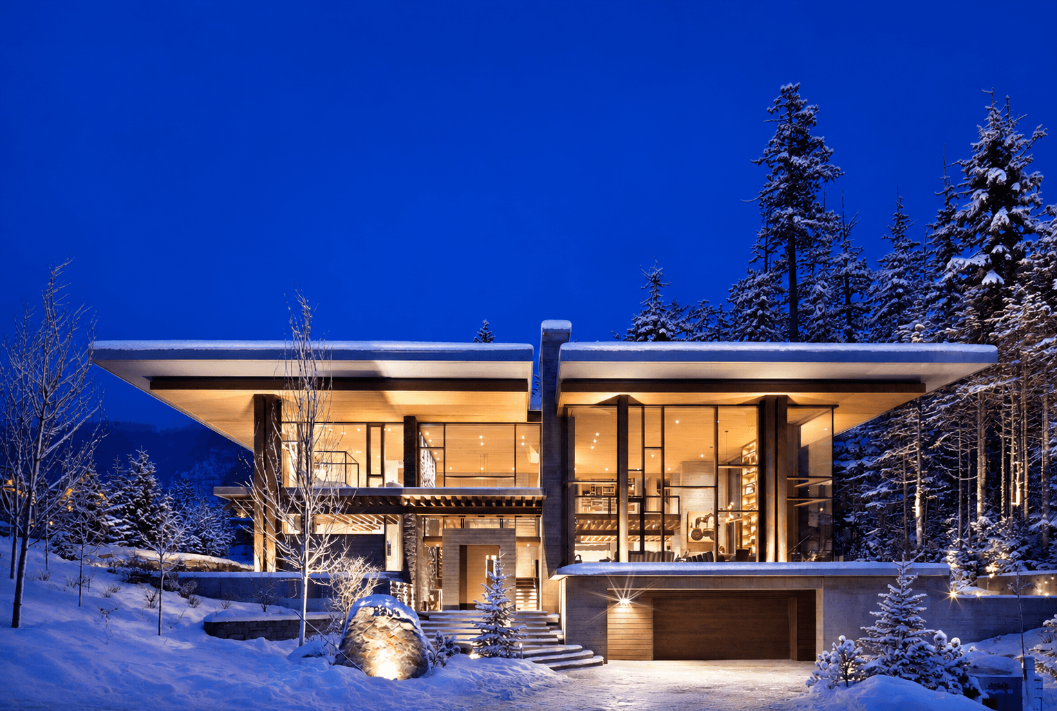
From ski-in ski-out condos to private luxury chalets, AceHost helps guests build exceptional Whistler winter stays around the mountain, dining, transportation and experiences that make the resort special.
Long-range forecasts are useful for understanding the big picture, but the best ski weeks are ultimately determined by individual storm cycles.
Whistler's enormous terrain, more than 10 metres of average annual snowfall and dramatic elevation range give visitors plenty of reasons to be optimistic about winter 2026/2027.
And if history repeats itself, January and February could be very interesting indeed.
We will continue updating this Whistler winter weather and snow forecast as new NOAA, Environment Canada and mountain-specific forecasts become available closer to the season.
For help planning your trip, explore our Whistler luxury vacation rentals, ski-in ski-out Whistler accommodation, and luxury Whistler chalets. Our Whistler concierge services can arrange private chefs, transportation and things to do in Whistler, while our guide to where to stay for a Whistler winter vacation helps you choose the right neighbourhood.
Forecast Sources
This forecast is based on information available in August 2026 from NOAA's Climate Prediction Center, Environment and Climate Change Canada, OpenSnow historical snowfall analyses and 2026/2027 winter outlook, official Whistler Blackcomb mountain statistics, NASA precipitation research and ECMWF/Copernicus material on ENSO.
Seasonal weather forecasts are probabilistic and become substantially more useful as winter approaches.